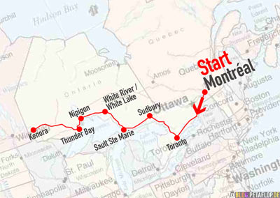
Sunday, 8. July 2007, Ontario, Canada. CDT, one timezone westward / eine Zeitzone westwärts (Deutschland – 7h).
Click to open PDF / Klick öffnet PDF
The thunderstorm in Thunder Bay was heavier than any we’ve seen before. During heavy rainfall and non stop thunder and lightning in the night we moved from the tent to the faraday car for our safety. Sleeping in the front seats wasn’t possible so we went back to the tent when the thunder storm paused for a short while. We had to recognize that our tent didn’t stand the downpour and so we had to sleep on the wet and again half-empty air mattress. Perhaps we made a mistake when building the tent.
Das Gewitter in Thunder Bay übertraf alles bisher erlebte und wir zogen nachts im Platzregen bei Dauerblitzlicht und Non-Stop-Donner sicherheitshalber auf die Vordersitze des faradayschen Autos. An Schlafen im Sitzen war auch hier nicht zu denken, in einer Gewitterpause kehrten wir ins Zelt zurück, das sich nun als undicht erwies; hoffentlich war’s nur ein Aufbaufehler. So betteten wir uns auf die inzwischen nasse und wieder halbleere Matzratze.
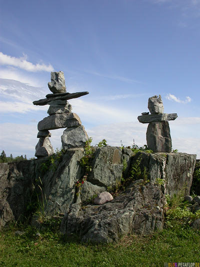
You can see these stone figures all along the Trans-Canada Highway. We thought they might be of Indian origin. The simple-minded girl at the reception of our campground today didn’t know more: “Might be something aboriginal”. Meanwhile we learned these are inuksuit, landmarks of the Inuit.
Überall am Trans-Canada Highway findet man solche Steinfiguren, wir vermuteten indianischen Ursprung. Das tumbe Mädchen an unserer heutigen Campingplatzrezeption in Kenora wusste leider auch nicht mehr: „Might be something aboriginal“ („Vielleicht was von Eingeborenen“). Mittlerweile wissen wir, dass es sich um sogenannte Inuksuit handelt, Wegweiser und Warnhinweise der Inuit.
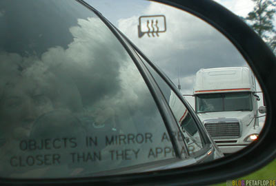
The maximum speed on highways in Ontario is 90 km/h. We’ve leveled off at 100-110 because everyone drives faster. Especially the truck drivers were very impatient today, we often felt like in the movie “Duel”. Sometimes there is no chance to overtake for about 20 km. On our today’s route we’ve seen our first black bear; unfortunately a run-over cub. Later a marmot, as fresh as a daisy.
Die Höchstgeschwindigkeit auf Highways in Ontario ist 90 km/h. Wir haben uns bei 100-110 eingependelt, da alle schneller fahren. Vor allem die Truckfahrer waren heute besonders hartnäckig im Drängeln, wir kamen uns öfter vor wie im Film „Duell“. Mancherorts gibt es über 20 km keine Überholmöglichkeit. Auf der Fahrt sahen wir unseren ersten Schwarzbären; leider ein überfahrenes Junges. Später noch ein quicklebendiges Murmeltier.
At some rest area / An irgendeinem Rastplatz
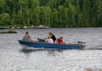
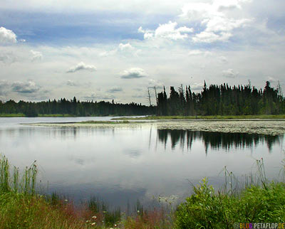
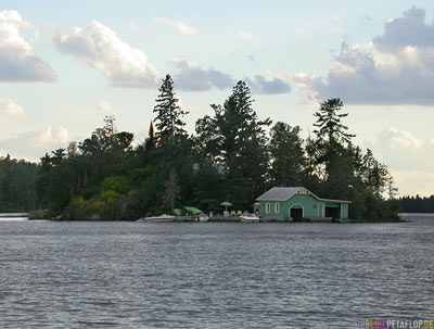
Views from our tent at the lake. Campground Anicinabe Park, Lake of the Woods, Kenora.
Impressionen von unserem Zelt am See. Campingplatz Anicinabe Park am Lake of the Woods in Kenora.

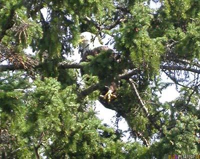
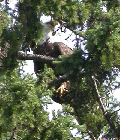
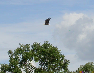
When we arrived a bald eagle landed in the tree above our heads. We were too slow with the cam when a second one flew by for a short fight or something like that.
Bei unserer Ankunft landete im Baum direkt über uns ein Weisskopfseeadler. Leider waren wir nicht schnell genug mit der Kamera als ein zweiter hinzukam und beide kurz miteinander kämpften, zumindest sah es danach aus.
20,000 Miles Canada/USA: Travel Overview
Hi,
I happened on your blog by accident and, as I am from Manitoba and have done a lot of cross-Canada driving, I found it quite interesting. I just wanted to give you more information on the Inuk-shuks on the side of the highway. Although traditionally built by the Inuit people, most, if not all, of those you see on the highways are built by people/tourists driving by on the highway, as the Inuit people’s lands are much farther north of the Trans-Canada highway.
Thanks for showing the pics along the trans canada. I lived in Kenora for many years and miss it greatly. I agree that the inukshuk is an inuit landmark. These however started showing up along the Trans-canada in northern Ontario if I recall around the late 90’s. I remember starting to see them around 1998/99. Mostly left by travellers stopping by a rock outcrop and leaving one behind. A kind of tourist graffitti.
I’ve had the priviledge of travelling the arctic and seeing true inukshuks in places like Repulse Bay. Most inukshuks in the arctic do not take the form of a person but are more commonly a pile of rocks left by the Inuit, to mark their way on a baron landscape where there are very few natural landmarks.
The Native groups around Kenora, Sioux Lookout and Thunder Bay are Ojibwe, and Oji-Cree. It is a shme to group natives all with one brush since each group is very different and unique.
Thanks for the pics though.